
Community, Diversity, Sustainability and other Overused Words
Community, Diversity, Sustainability and other Overused Words
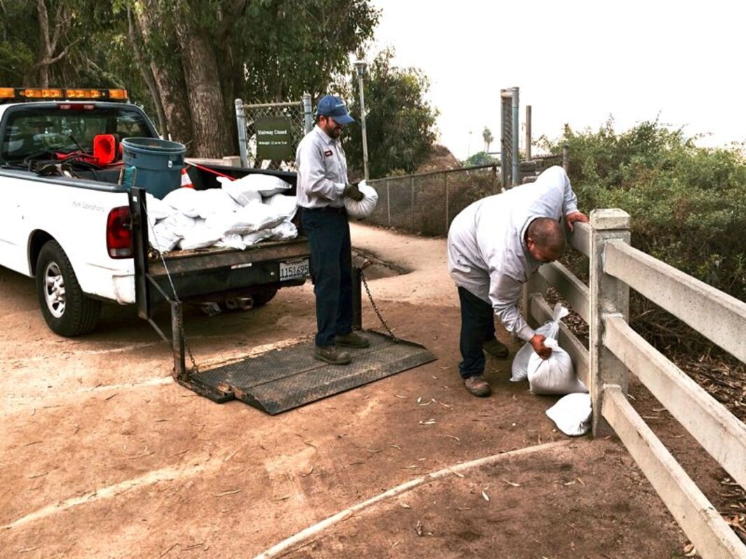
12/11/14: Workers from the City Division of Public Works place sandbags along the cliffs at Palisades Park, to direct water to flow down the pedestrian ramp and storm drain, rather than over the edge of the cliffs causing erosion. A high surf advisory will take effect tonight and remain in force through Saturday, National Weather Service forecasters said. A powerful storm will bring pounding surf along the coast, with the second of two westerly swells reaching the outer waters Thursday afternoon and spreading. Forecasters said the high surf is likely to cause significant beach erosion and flood piers and jetties, low-lying areas and beachside parking lots. They said waves of between 7 and 10 feet are expected, with local sets of up to 13 feet along some west-facing beaches. "Avoid standing on jetties, piers and rocks near the edge of the water," warned an NWS statement. "Remember to never turn your back to the ocean during large surf events.
With a major storm moving toward the Southland, the weather service is warning of wild weather including heavy wind and rain, thunderstorms, and low snow levels.
residents near the Colby Fire burn area in Glendora were bracing again today for possible mudslides and flooding.
The storm is expected to arrive in the Los Angeles area late Thursday and continue through Friday. National Weather Service forecasters said the storm could dump 1 to 2 inches of rain on coastal and valley locations, and 2 to 4 inches in foothills and mountains. The rain will accompanied by strong winds and mountain snow.
"This weather system will also bring a slight chance of thunderstorms to the region, where there will be the potential for brief high-intensity rainfall, small hail and gusty winds," according to an NWS statement. "Rainfall rates between one-half and three-quarters of an inch per hour will be possible with the cold front and thunderstorm development."
Forecasters said the storm, while shorter than last week's rain event, could dump more of the wet stuff on the region.
A flash flood watch will be in effect in Los Angeles County mountains and the Antelope and San Gabriel valleys from late Thursday into Friday for recent burn areas, with forecasters noting that showers and thunderstorms could linger after the brunt of the storm system passes.
"Due to the potential for intense rainfall along the cold front, and with the showers and thunderstorms behind the front, there is the possibility of dangerous flash flooding and mud and debris flows in the recent burn areas of Ventura and Los Angeles counties," according to the NWS.
In response to the possibility of flooding in the Powerhouse Fire burn area, Los Angeles County officials said a 4.6-mile stretch of Lake Hughes Road south of Elizabeth Lake Road will be closed at 12:30 a.m. Friday and remain blocked until the storm passes and the street can be inspected.
Forecasters also noted that powerful winds can be expected, with gusts of more than 70 mph possible in the mountains, and gusts between 35 and 50 mph in coastal and valley locations.
Snow levels, meanwhile, will initially be above the resort level, but dip to about 5,000 feet on Friday afternoon.
"There could be a brief mix of rain and snow at the summit of the Grapevine on Interstate 5, however, no accumulations are expected," according to the Weather Service.
Snow accumulations in upper mountain elevations could reach up to 10 inches, forecasters said.


Reader Comments(0)