
Community, Diversity, Sustainability and other Overused Words
Community, Diversity, Sustainability and other Overused Words
Clouds will increase over the north, with a slight chance of a shower or thunderstorm near the Oregon State line late today into early Wednesday
Clouds will increase over the north, with a slight chance of a shower or thunderstorm near the Oregon State line late today into early Wednesday
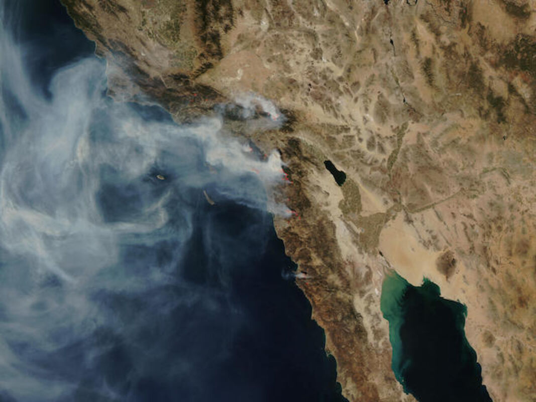
NASA Image of California fires
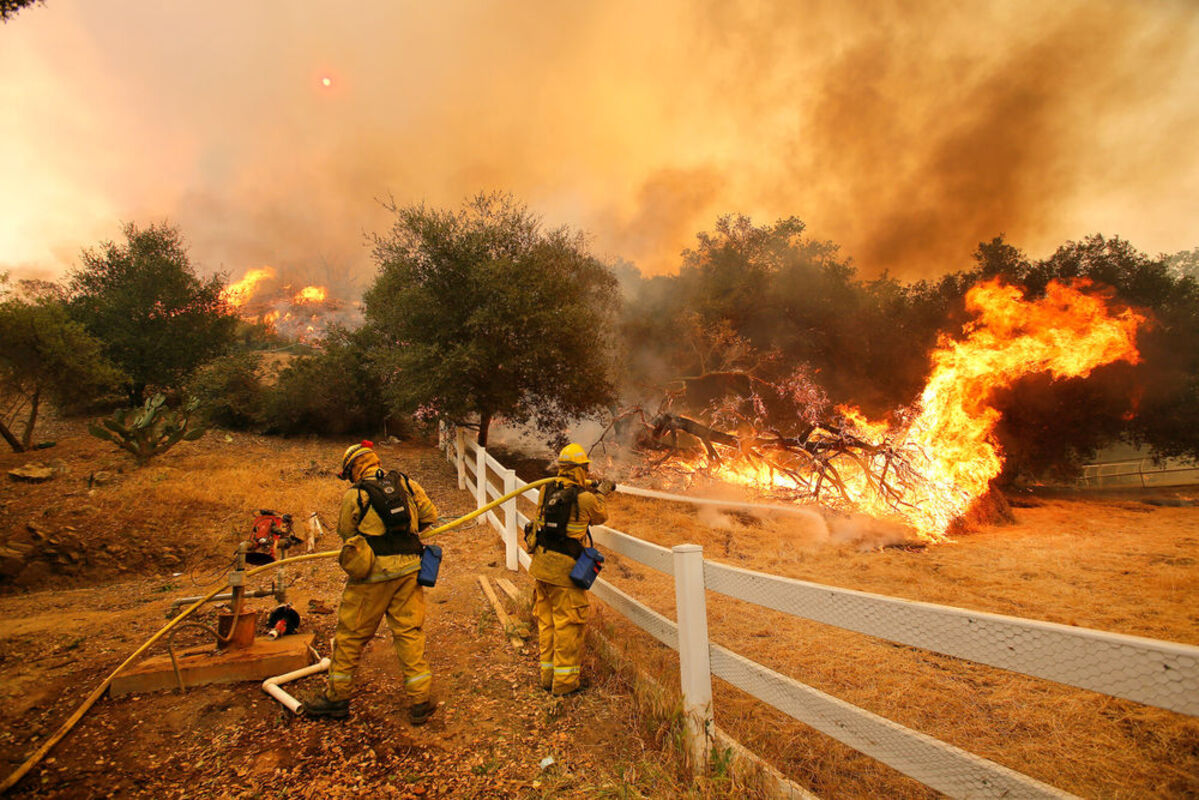
7/05/16: More than 5,200 firefighters are battling 14 wildfires throughout California. A low pressure trough over the West Coast will deepen through early Wednesday then move east. Clouds will increase over the north, with a slight chance of a shower or thunderstorm near the Oregon State line late today into early Wednesday. A weak high pressure ridge will follow, but the next trough will approach the region by late Thursday.
This trough will produce about the same results as the current one, a cooling trend with more clouds and increasing southwest to northwest winds. Temperatures will be near normal today In Southern California, a calm weather pattern is expected this week as a pair of weak troughs stay over the Pacific Northwest. The troughs will maintain a dry southwesterly flow with onshore flows. Westerly afternoon winds of 15 to 25 mph with gusts to 40 mph will surface across the mountain ridges and desert passes through this weekend.
In California, wildfires aren't a question of if, but only a question of when. If you choose to live near a natural area of the state, you are at risk for wildfires and it's your responsibility to prepare yourself, your family, and your home. Being prepared includes a wildfire action plan, along with an emergency supply kit for you, your family and your pets. For detailed information, go to ReadyForWildfire.org.
Fires of Interest:
**CAL FIRE Incidents**
Frame Fire, Fresno County, NEW
Hwy 198 and Frame Ln, 14 miles west of Coalinga
· 145 acres grass, brush, 25% contained
· 1 structure destroyed
Broken Fire, Madera County,NEW
Hwy 41 and Hummingbird Ln, One mile east of Coarsegold
· 103 acres grass, oak woodland, 80% contained
· All threats mitigated
Curry Fire, Fresno County
Curry Mountain and Hwy 198, 7 miles southwest of Coalinga
· 2,944 acres grass, brush, 95% contained
Deer Fire, Kern County
Hwy 223 and Deertrail Rd., 6 miles east of Arvin
· 1,785 acres grass, brush, 80% contained
· All Evacuations lifted
Appaloosa Fire, Calaveras County
Appaloosa Rd. and Pinto Dr., 5 miles southwest of Angels Camp
· 310 acres grass, brush, 75% contained
**Unified Command Incidents**
Trailhead Fire, Placer and El Dorado Counties
Near Todd Valley, Foresthill
· 5,565 acres brush and slash, 50% contained
· All mandatory evacuations have been lifted
· Minimal fire activity overnight
Erskine Fire, Kern County
Lake Isabella area
Unified Command: Kern County Fire, USFS and Bureau of Land Management
· 48,019 acres, 95% Contained
Sherpa Fire, Santa Barbara County
West of Goleta
Unified Command: USFS and Santa Barbara County Fire
· 7,474 acres, 96% Contained
San Gabriel Complex, Los Angeles County
North of Duarte and Azusa
Unified Command: USFS & LA County Fire
· 5,399 acres, 96% contained
· Two separate fires: Fish Fire (4,253 acres/96%) and Reservoir Fire (1,146 acres/96%)
**Federal Incidents**
Mile Post 21.68 Fire, Humboldt County,
1mile south of Weitchpec, North of Hoopa
· 40 acres brush, timber, 20% contained
· Continued commitment of CAL FIRE ground resources
Pine, Ventura County
San Guillermo Mountain, 6 miles Southwest of Stauffer, Federal DPA, FRA
· 1,814 acres brush, timber, 15% contained
Marina Fire, Mono County
Near Lee Vining
US Forest Service - Inyo National Forest
· 654 acres, 95% contained
· CAL FIRE ground resources assisting
Pony Fire, Siskiyou County
15 miles southwest of Happy Camp
US Forest Service - Klamath National Forest
· 2,858 acres, 90% contained


Reader Comments(0)